Singapore: Singapore Geography Profile
2015/02/17
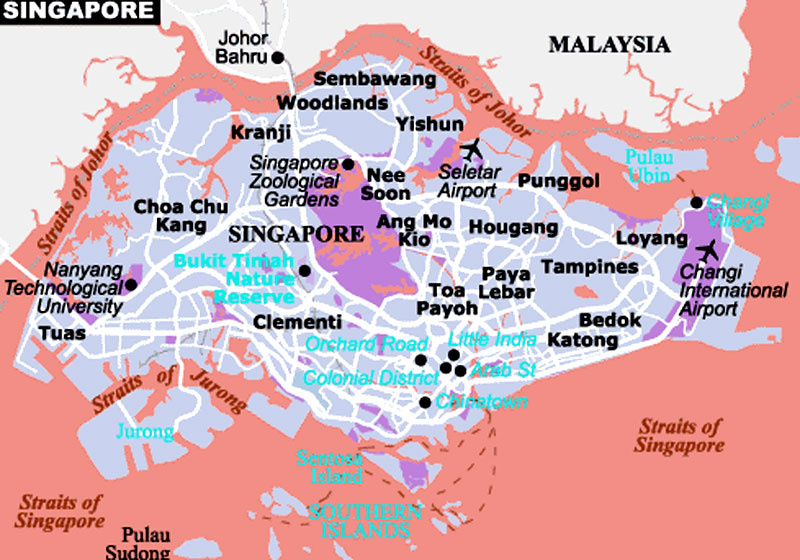
The Country
Singapore Island and a number of smaller adjacent islands make up the country. They lie just north of the Equator at the tip of the Malay Peninsula. With an area of only 224 square miles (580 km2)—about the size of Chicago—Singapore is one of the smallest independent countries in Asia.
Singapore Island is separated from the southern tip of the Malay Peninsula by the narrow Johor Strait. To the south beyond Singapore Strait, the major link between the South China Sea and the Strait of Malacca, are islands of Indonesia. Singapore Island is generally low-lying and flat; its few hills reach less than 600 feet (180 m) above sea level. Because of the equatorial location, Singapore's climate is tropical. High temperatures and humidity prevail, and there is almost daily rainfall.
The City
On the southern coast of the island is the densely settled city of Singapore, its inhabitants crowded into an area of less than 40 square miles (100 km). The city is a busy seaport and commercial center with docks, warehouses, and other harbor facilities lining much of the waterfront. Winding through the city is the narrow Singapore River, its banks often cluttered with barges that serve |ships anchored offshore.
The downtown area is near the mouth of the river. Many of the buildings here are modern high-rises. Wide avenues enclose shopping areas, parks, and attractive squares. Hotels and clubs along Beach Road face the harbor, and tall apartment buildings are visible in many areas. Of interest are the Botanical Gardens, noted for tropical plants; the National Museum, with exhibits on Malayan and Indonesian culture; and several large amusement districts with theaters and other types of entertainment facilities.
Location:
Southeastern Asia, islands between Malaysia and Indonesia
Geographic coordinates:
1 22 N, 103 48 E
Map references:
Southeast Asia
Area comparative:
slightly more than 3.5 times the size of Washington, DC
Land boundaries Total:
0 km
Land boundaries Note:
Climate:
tropical; hot, humid, rainy; two distinct monsoon seasons - Northeastern monsoon (December to March) and Southwestern monsoon (June to September); inter-monsoon - frequent afternoon and early evening thunderstorms
Terrain:
lowland; gently undulating central plateau contains water catchment area and nature preserve
Natural resources:
fish, deepwater ports
Natural hazards:
NA
Environment - current issues:
industrial pollution; limited natural fresh water resources; limited land availability presents waste disposal problems; seasonal smoke/haze resulting from forest fires in Indonesia
Geography note:
focal point for Southeast Asian sea routes

- Singapore News
-
- SINGAPORE: Singapore launches new strategy for human resource industry
- SINGAPORE: Singapore And Food Security
- BRUNEI : The next chapter for the Trans-Pacific Partnership
- JAPAN: BestCities sees opportunity at 2017 Global Forum Tokyo
- AFGHANISTAN: Higher earning Why a university degree is worth more in some countries than others
- AZERBAIJAN: Israel purchases most of its oil from Kazakhstan and Azerbaijan.

- Trending Articles
-
- ISRAEL: Hungary's Orban welcomes Netanyahu, vows to fight anti-Semitism
- EGYPT: Egypt's EFG HERMES to invest $21.5 mln in asset manager FIM
- ZIMBABWE: Cash-strapped Zimbabwe needs $274 million for 2018 election
- TANZANIA: Farmers pushed off their land to save Tanzania's Great Ruaha River
- ANGOLA: W. Africa Crude-Angolan programme emerges
- ZIMBABWE: Zimbabwe: 'So Many Questions' - Zim Bans Polystyrene, but Are There Alternatives?