Americas > South America > Uruguay > Uruguay Geography Profile

Uruguay: Uruguay Geography Profile

2015/08/11

Land

Grassy plains is predominate, particularly in the southwest, which is part of the Pampas region. Hilly land occurs as ridges called cuchillas. Uruguay's highest point, 1,644 feet (501 m), is in the Cuchilla Grande near the Atlantic coast. Sandy beaches, dunes, and shallow lagoons are part the features along the coast.Most of the country's land is low-lying and flat to gently rolling.

Water

He is drained by the Uruguay and Negro rivers. The Uruguay flows southward along the western border and joins the Paraná River, forming the broad estuary known as the Río de la Plata. The Negro River flows southwestward across Uruguay from Brazil, draining the land between the Cuchilla Grande and the Cuchilla de Haedo. Large amounts of hydroelectric power are generated on the Uruguay and Negro rivers. Río Negro Reservoir, impounded by a hydroelectric dam on the Negro, is one of the major human-made lakes in South America. Uruguay shares the Mirim Lagoon with Brazil.

Climate

A mild climate has helped make Uruguay's coast one of South America's most popular tourist attractions. January, the warmest month, averages 74° F. (23° C); June, the coldest, averages nearly 50° F. (10° C.). There are hot periods occasionally during summer. Rainfall totals about 40 to 50 inches (1,020 to 1,270 mm) a year. Short droughts periodically occur.

Topography

The general character of the land is undulating hills, with a few forest areas along the banks of the numerous streams. Southern Uruguay consists mostly of rolling plains and is an eastward extension of the Argentine pampas. The Atlantic coastline is fringed with tidal lakes and sand dunes. Low, unbroken stretches of level land line the banks of the two border rivers, the Uruguay and the Plata. The northern section is broken by occasional ridges and low ranges (cuchillas), alternating with broad valleys, and is a southern extension of Brazil. The highest point in the country, Catedral, is 514 m (1,686 ft) above sea level. The majority noteworthy feature of the northwest landscape is the Cuchilla de Haedo. The Cuchilla Grande runs northeastward from the southern region to the Brazilian border. The Negro, which rises in Brazil, crosses Uruguayan territory and flows into the Uruguay River, which separates Uruguay from Argentina.
 

Flora and fauna

Uruguay is primarily a grass-growing land, with vegetation that is essentially a continuation of the Argentine pampas. Forest areas are relatively small. The majority useful hardwoods are algarobo, guayabo, quebracho, and urunday; other hardwoods include arazá, coronilla, espinillo, lapacho, lignum vitae, and nandubay. The acacia, alder, aloe, eucalyptus (imported from Australia), ombú, poplar, and willow are common softwoods. Palms are indigenous to the valleys. Rosemary, myrtle, scarlet-flowered ceibo, and mimosa are common. Most of the valleys are covered with aromatic shrubs while the rolling hills are blanketed with white and scarlet verbena.
Large animals have virtually disappeared from the eastern regions. The carpincho (water hog), fox, deer, nutria, otter, and small armadillo roam the northern foothills. On the pampas are the hornero (ovenbird), quail, partridge, and crow. The avestruz (a small ostrich similar to the Argentine rhea), swan, and royal duck are found at lagoons. Fish include pompano, salmon, and corvina. The principal reptiles are cross vipers and tortoises. Seals are found on Lobos Island, near Punta del Este.
 
Location: 

Southern South America, bordering the South Atlantic Ocean, between Argentina and Brazil

Geographic coordinates: 

33 00 S, 56 00 W

Map references: 

South America

Area comparative: 

slightly smaller than the state of Washington

Land boundaries Total: 

1,648 km

Land boundaries Note: 

Climate: 

warm temperate; freezing temperatures almost unknown

Terrain: 

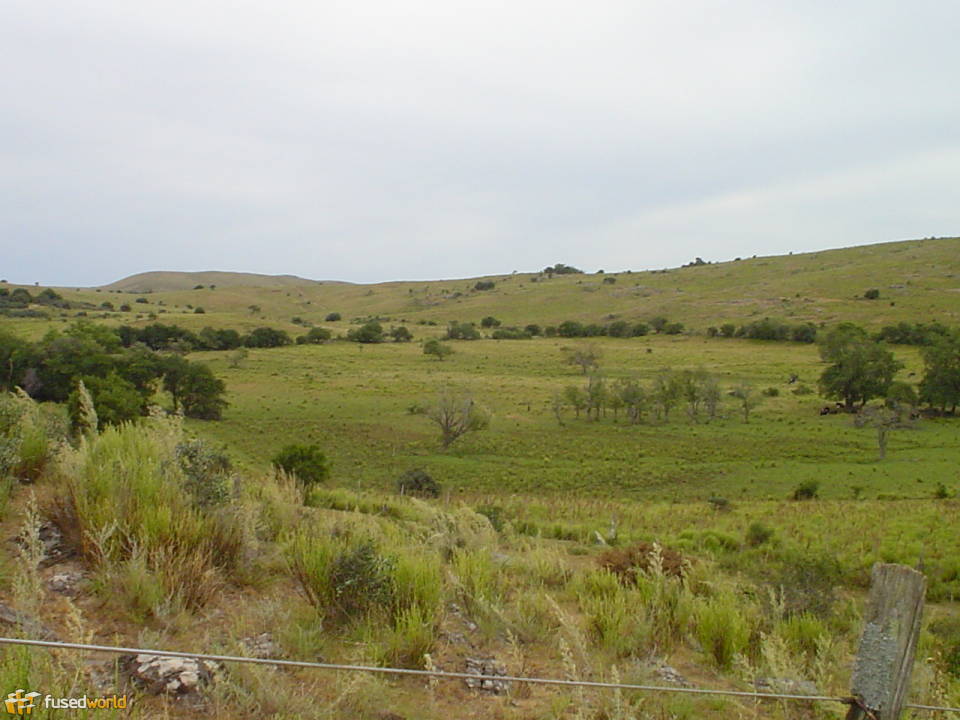
mostly rolling plains and low hills; fertile coastal lowland

Natural resources: 

arable land, hydropower, minor minerals, fisheries

Natural hazards: 

seasonally high winds (the pampero is a chilly and occasional violent wind that blows north from the Argentine pampas), droughts, floods; because of the absence of mountains, which act as weather barriers, all locations are particularly vulnerable to rapid changes from weather fronts

Environment - current issues: 

water pollution from meat packing/tannery industry; inadequate solid/hazardous waste disposal

Geography note: 

second-smallest South American country (after Suriname); most of the low-lying landscape (three-quarters of the country) is grassland, ideal for cattle and sheep raising