


India: India Geography Profile
2016/12/04
Geographically, the Indian subcontinent is a peninsular region south of the Himalayas and Kuen Lun mountain ranges and east of the Hindu Kush mountain range and Balochistan region, extending southward into the Indian Ocean between the Arabian Sea (to the southwest) and the Bay of Bengal (to the southeast). It covers about 4,480,000 km² (1,729,738 mi²) or 10 % of the Asian continent; however, it accounts for about 40 % of Asia's population.
Geologically, most of this region is a subcontinent: it rests on a tectonic plate of its own, the Indian Plate (the northerly portion of the Indo-Australian Plate) separate from the rest of Eurasia, and was once a small continent before colliding with the Eurasian Plate and giving birth to the Himalayan range and the Tibetan plateau. Even now the Indian Plate continues to move northward resulting in increase in height of the Himalayas by a few centimeters each decade. On its western frontier, the Indian Plate forms a conservative boundary with the Eurasian Plate. In addition, it is also home to an astounding variety of geographical features, such as glaciers, rainforests, valleys, deserts, and grasslands that are typical of much larger continents.
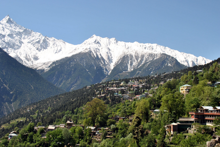
The geography of India is diverse, with landscape ranging from snow-capped mountain ranges to deserts, plains, rainforests, hills, and plateaus. India comprises most of the Indian subcontinent situated on the Indian Plate, the northerly portion of the Indo-Australian Plate. Having a coastline of over 7,000 kilometres (4,350 mi), most of India lies on a peninsula in Southern Asia that protrudes into the Indian Ocean. India is bounded in the southwest by the Arabian Sea and in the east and southeast by the Bay of Bengal.
The fertile Indo-Gangetic Plain occupies most of northern, central, and eastern India, while the Deccan Plateau occupies most of southern India. To the west of the country is the Thar Desert, which consists of a mix of rocky and sandy desert. India's east and northeastern border consists of the high Himalayan range. The highest point in India is disputed due to a territorial dispute with Pakistan; according to India's claim, the highest point (located in the disputed Kashmir region) is K2, at 8,611 metres (28,251 ft). The highest point in undisputed Indian territory is Kangchenjunga, at 8,598 m (28,209 ft). Climate ranges from equatorial in the far south, to Alpine in the upper reaches of the Himalayas.
India is bordered by Pakistan to the north-west, China, Bhutan and Nepal to the north, Myanmar to the east and Bangladesh to the east of West Bengal. Sri Lanka, the Maldives and Indonesia are island nations to the south of India. Sri Lanka is separated from India by a narrow channel of sea formed by Palk Strait and the Gulf of Mannar.Politically, India is divided into 28 states, and seven federally administered union territories. The political divisions generally follow linguistic and ethnic boundaries rather than geographic transitions.
Southern Asia, bordering the Arabian Sea and the Bay of Bengal, between Burma and Pakistan
20 00 N, 77 00 E
Asia
slightly more than one-third the size of the US
4,863 km
varies from tropical monsoon in south to temperate in north
upland plain (Deccan Plateau) in south, flat to rolling plain along the Ganges, deserts in west, Himalayas in north
coal (fourth-largest reserves in the world), iron ore, manganese, mica, bauxite, titanium ore, chromite, natural gas, diamonds, petroleum, limestone, arable land
droughts; flash floods, as well as widespread and destructive flooding from monsoonal rains; severe thunderstorms; earthquakes
deforestation; soil erosion; overgrazing; desertification; air pollution from industrial effluents and vehicle emissions; water pollution from raw sewage and runoff of agricultural pesticides; tap water is not potable throughout the country; huge and growing population is overstraining natural resources
dominates South Asian subcontinent; near important Indian Ocean trade routes; Kanchenjunga, third tallest mountain in the world, lies on the border with Nepal

- India News
-
- CHINA: Indian economic diplomacy in the Belt and Road era
- INDIA: Triple Challenge For Agriculture: Trade, Food Security And New Technologies
- ARMENIA: Crimea: Circumventing Trade Sanctions Via Novorossiysk
- INDIA: Israel and India Relations Warm As Netanyahu, Modi Take Awkward Barefoot Beach Stroll
- INDIA: Indian Prime Minister Modi and Israeli Prime Minister Netanyahu
- INDIA: Modi d’action: Israel and India

- Trending Articles
-
- SOUTH KOREA: Launch of the Trump–Moon era
- ISRAEL: Pelephone CEO: Mobile revolution just beginning
- NIGERIA: Nigeria: Afrexim Signs $1.1bn Loans With Dangote, Elumelu's Heirs Holdings
- GAMBIA: Gambia: The Country On Funding Drive to Become First Sub-Saharan Nation Free of Malaria
- BOTSWANA: Africa: 'Market Information Gap Threatens U.S.$400 Billion Intra-Africa Trade'
- NIGERIA: Nigeria: 30 States Could Experience Flooding, Govt Warns


