


Asia: Afghanistan Geography Profile
2012/02/15
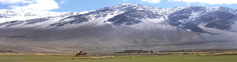
Afghanistan is a mountainous country with plains to the north and south-west. The highest point of the country at 7485 m above the sea, is Noshaq. Large parts of the country is arid, and fresh water is limited. Afghanistan is a continental climate with hot summers and cold winters. The country is frequently subject to earthquakes.
The major cities of Afghanistan are its capital Kabul, Herat, Jalalabad, Mazar-i-Sharif and Kandahar.
Afghanistan is a landlocked nation in south-central Asia. Strategically located at the crossroads of major north-south and east-west trade routes, it has attracted a succession of invaders including Alexander the Great, in the fourth century B.C. Currently, the United States continues the global war on terrorism there.
Southern Asia, north and west of Pakistan, east of Iran
33 00 N, 65 00 E
Asia
slightly smaller than Texas
5,529 km
arid to semiarid; cold winters and hot summers
mostly rugged mountains; plains in north and southwest
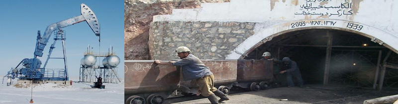
Natural gas, petroleum, coal, copper, chromite, talc, barites, sulfur, lead, zinc, iron ore, salt, precious and semiprecious stones.
damaging earthquakes occur in Hindu Kush mountains; flooding; droughts
limited natural fresh water resources; inadequate supplies of potable water; soil degradation; overgrazing; deforestation (much of the remaining forests are being cut down for fuel and building materials); desertification; air and water pollution
landlocked; the Hindu Kush mountains that run northeast to southwest divide the northern provinces from the rest of the country; the highest peaks are in the northern Vakhan (Wakhan Corridor)

- Related Articles
-
Asia Geography Profile
2012/08/14 更多 -
Geography
2010/08/09
-
- Asia News
-
- CHINA: United States sees China investment talks ‘productive’ after new offers
- INDIA: Indian central bank chief to step down in surprise move
- SERBIA: China’s Xi sees Serbia as milestone on new ‘Silk Road’
- THAILAND: Foreign investment plummets in junta ruled Thailand
- CHINA: Djibouti partners with China to develop local infrastructure and global trade routes
- INDIA: Bangalore, India gives Seychelles a special welcome

- Trending Articles
-
- AUSTRALIA: Australia taxes foreign home buyers as affordability bites
- CHINA: United States sees China investment talks ‘productive’ after new offers
- SERBIA: China’s Xi sees Serbia as milestone on new ‘Silk Road’
- INDIA: Indian central bank chief to step down in surprise move
- THAILAND: Foreign investment plummets in junta ruled Thailand
- SOUTH AFRICA: South Africa to extend ICT reach

.gif?1356023993 "Business Park of Mauritius Ltd, Mauritius")


